Vermont's highways traverse some of the most geologically challenging terrain in New England — and the rock cuts that were blasted through it decades ago are deteriorating. A preliminary VTrans field survey identified over 3,600 rock cuts greater than five feet in height on Vermont's Interstate, US, and state highways. Of those, 10 percent were rated elevated hazard and 2 percent significant — meaning rockfall is possible or likely to reach the travel lanes. The consequences are documented. A 2012 rockfall on I-89 in Berlin closed northbound lanes for two days and required hand scaling by a specialty contractor to clear the slope. VT-108 through Smugglers Notch sees recurring rockfall events from the schist formations above the highway, where large blocks of metamorphic rock bounce and roll onto the roadway after release.
The geology driving these events is consistent across Vermont's Green Mountains and Piedmont: metamorphic rock — schist, gneiss, quartzite, phyllite — cut by foliation planes, joints, and faults that Vermont's harsh northern climate progressively opens. Each freeze-thaw cycle infiltrates water into fractures, expands them, and moves blocks incrementally toward release. Many of Vermont's rock cuts were constructed using uncontrolled blasting techniques that left slopes uneven and structurally compromised from the start.
Rock bolts mechanically pin identified unstable blocks to competent rock behind them — preventing release before it occurs. On Vermont's foliated metamorphic rock cuts, where schist and phyllite layers dip toward the road and individual blocks are bounded by foliation planes and crossing joint sets, targeted rock bolt programs can arrest the progressive failure mechanism before blocks reach the trajectory zone.
GeoStabilization International's engineers map discontinuity orientations and block geometry at each Vermont site before specifying a single bolt — matching bolt length, pattern, and anchorage type to the actual failure mechanics at your corridor.
Where source area treatment alone cannot eliminate rockfall risk — particularly on Vermont's steeper slopes where block volume and velocity exceed what bolting can address — GeoStabilization International designs interception systems calibrated to the site. Every barrier specification is driven by 3D trajectory modeling using Vermont's specific slope geometry and rock block characteristics, not generic catalog ratings.
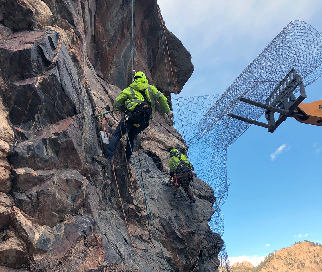
Precision removal of loose and marginally stable rock eliminates the source material before it releases. On Vermont's vertical and near-vertical rock faces — particularly along steep highway cuts and mountain corridor routes like Smugglers Notch — GeoStabilization International's SPRAT- and IRATA-certified Rockfall Remediation Technicians work from industrial rope access, removing hazards from terrain where no conventional equipment can safely operate.

Site-specific rock mass characterization. Vermont's metamorphic geology — schist, gneiss, phyllite — behaves differently from sedimentary or volcanic rock. Our geologists map foliation dip, joint orientation, and weathering profiles before engineers specify a single bolt or barrier.
Rope access and SPIDER excavator capability. We install on vertical faces without road closures or access road construction — keeping Vermont's corridors operational during protection work.
3D trajectory simulation. Every barrier specification is driven by modeled block trajectories calibrated to Vermont's slope geometry — not catalog ratings from unrelated formations.
VTrans specification compliance. Documentation meets state standards from first submittal through construction closeout.
VTrans has identified hundreds of elevated and significant hazard slopes statewide — and Vermont's freeze-thaw cycles keep deteriorating them. Engineered protection before the next release costs far less than emergency cleanup after it. Request a rockfall assessment to get started.