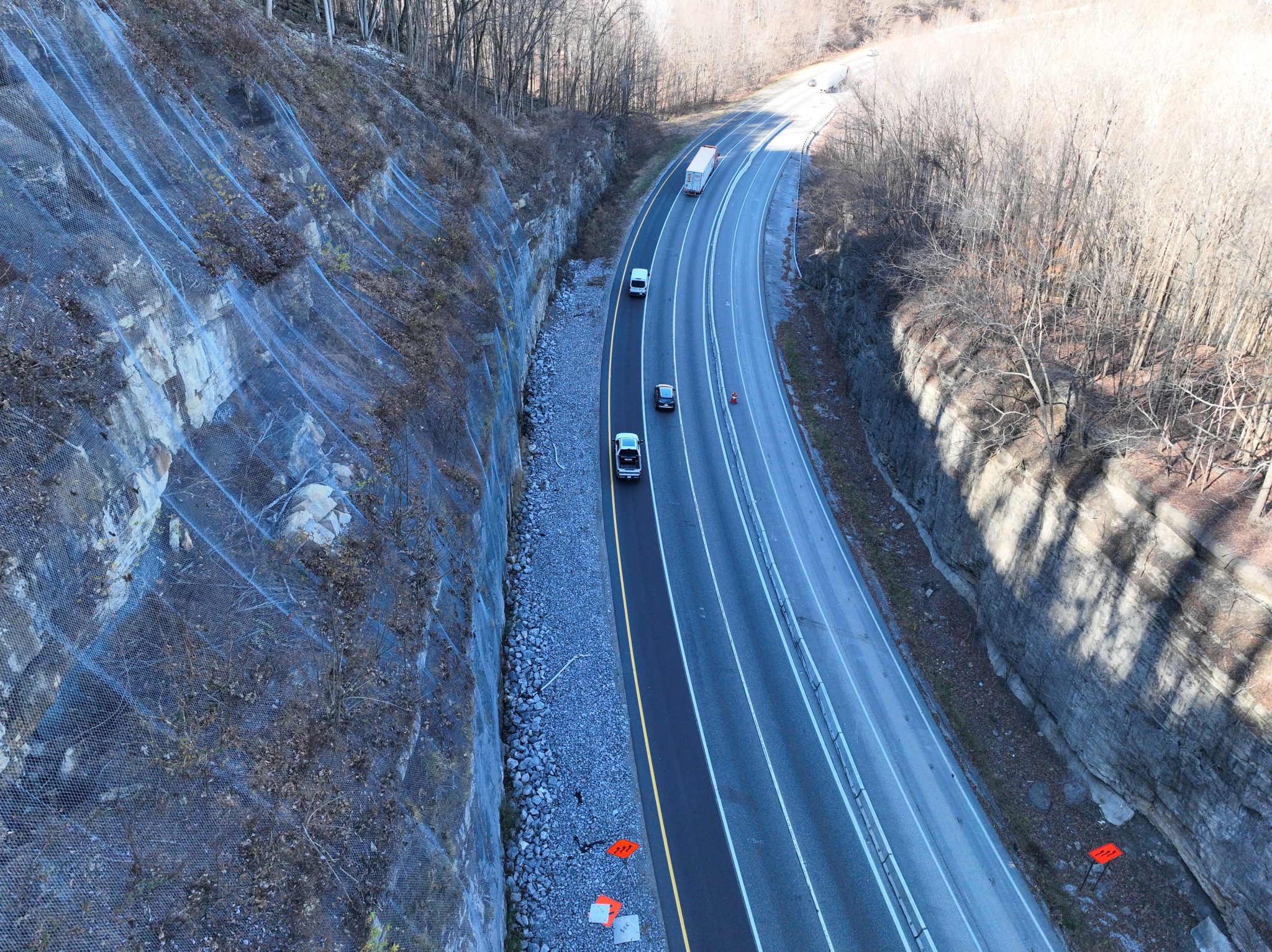
Texas's western highways—US-90 approaching Big Bend, FM-170 (River Road) along the Rio Grande, I-35 through Georgetown's limestone cuts, and US-83 at the Pecos River crossing—traverse fractured limestone, sandstone, and shale formations that produce rockfall events ranging from individual block failures to massive cliff collapses. TxDOT manages rockfall hazards across these corridors where steep rock cuts and canyon geometry create high-energy impact zones directly above travel lanes.
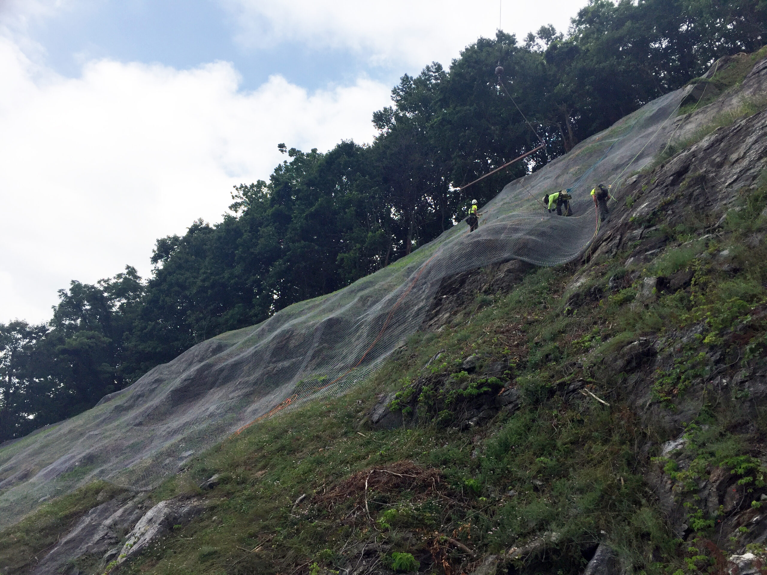
GeoStabilization International designs rock bolt systems and attenuator barriers engineered for Texas's specific carbonate and sandstone rock mass conditions—accounting for the thermal cycling that drives rock fatigue in the state's extreme temperature environment.
Texas's western and central rock cut highways produce rockfall conditions that most people do not associate with the Lone Star State. US-90 approaching Big Bend features massive limestone cliff faces along the Rio Grande corridor. FM-170 (River Road) traverses vertical canyon walls above the river. I-35 through Georgetown cuts through fractured Edwards Limestone. US-83 at the Pecos River crossing exposes unstable sandstone and shale formations. TxDOT manages these rockfall hazards across corridors where extreme heat cycles drive thermal rock fatigue.
Texas rockfall conditions are driven by thermal cycling—daily temperature swings of 40-60°F that fatigue rock along discontinuities over thousands of cycles. GeoStabilization International designs protection systems accounting for these Texas-specific deterioration mechanisms, specifying UV-resistant mesh materials, corrosion protection rated for the state's exposure conditions, and anchor systems designed for the carbonate and sandstone formations that dominate Texas's rockfall corridors.
Our Texas rockfall mitigation combines mechanical stabilization—pattern rock bolts that pin identified unstable blocks—with passive interception—attenuator barriers positioned in trajectory zones to decelerate falling rock before it reaches travel lanes. Each system is specified using 3D trajectory simulation calibrated to site-specific slope geometry and rock block characteristics.
Texas's extreme daily temperature swings—40-60°F differentials—drive rock fatigue along discontinuities at rates that continental or marine climates do not produce. GeoStabilization International's engineers account for this thermal cycling in every Texas rockfall design, specifying bolt torque values, mesh tension requirements, and barrier anchor capacities that accommodate thermal expansion and contraction cycles. This desert-specific expertise ensures your protection system performs through Texas's demanding climate conditions.
Highway agencies across the American West share their experience with GeoStabilization International's canyon and desert rockfall protection.
Big Bend to Georgetown—GeoStabilization International delivers desert-rated rockfall protection across Texas's canyon and rock cut corridors. Contact our team today.