Western Maryland's Ridge-and-Valley terrain concentrates some of the most geologically complex rockfall conditions on the East Coast. At Sideling Hill on I-68, a 340-foot-deep road cut blasted through a tightly folded syncline exposes over 810 feet of alternating Devonian and Mississippian sandstones, shales, siltstones, and conglomerates — rock types that weather and fail at dramatically different rates. That differential erosion, where soft shales undercut beneath massive sandstone units, is one of the primary failure mechanisms driving ongoing rockfall risk along the cut's benched slopes.
Allegany County presents the highest concentration of rockfall-susceptible road cuts in Maryland. The Maryland Geological Survey inventoried 195 road cuts on MDSHA-maintained roads in Allegany and Garrett counties, identifying rockfall, rock roll, slides, and slumping across the Ridge-and-Valley corridor. The most prominent area of documented slope instability runs along MD-135 at the border of Allegany and Garrett counties — where precipitous slopes, differential erosion of interbedded lithologies, and adverse joint orientation combine to produce conditions the Maryland Geological Survey described as an area of perpetual slope instability and failure.
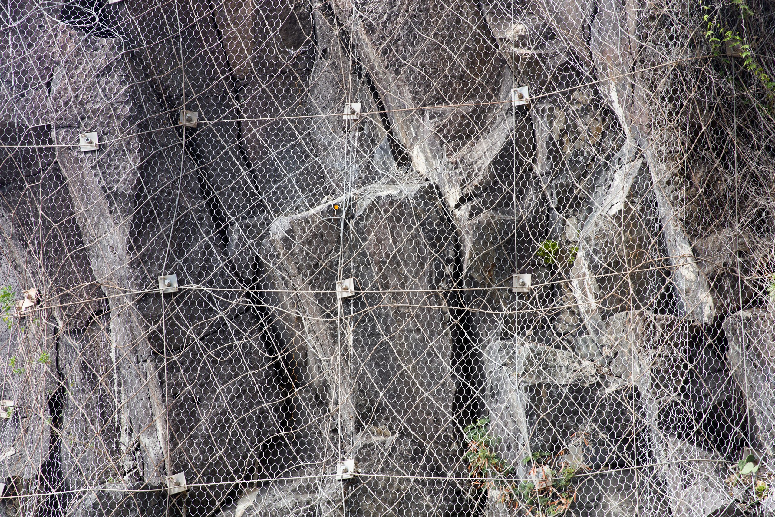
GeoStabilization International delivers rock bolts, draped mesh, attenuator barriers, and scaling operations across Maryland's most active corridors — with in-house geotechnical engineers who design every solution and field crews who execute it under a single MDSHA-ready contract.
Maryland's Ridge-and-Valley rock cuts don't behave uniformly. At Sideling Hill, the interbedded sandstones and carbonaceous siltstones create differential weathering conditions where hard units overhang softer material below — a classic block topple and wedge failure setting. Along MD-135 and the Georges Creek Valley corridor, steep slopes with adversely oriented fracture planes produce rockfall conditions that require site-specific trajectory modeling and protection system sizing, not standard specifications. The Maryland Geological Survey's Allegany County inventory confirmed that fracture planes continuous and adverse to the roadway are the dominant factor correlating with slope failure across western Maryland road cuts. GeoStabilization International's engineers assess those fracture characteristics directly at your site before any protection system is specified — matching bolt patterns, mesh coverage, and barrier energy ratings to the actual failure mechanics of your slope.
Many of Maryland's highest-risk rockfall corridors carry significant freight and commuter traffic that cannot be fully closed during mitigation work. GeoStabilization International's crews are experienced in executing rock bolt installation, mesh deployment, and barrier construction under maintained traffic conditions — using staged work sequences and compact equipment that minimize lane impact while keeping the project on schedule.
MDSHA and Maryland's infrastructure stakeholders rely on GeoStabilization International's integrated design-build delivery. The engineers who characterized your slope's geology and modeled failure trajectories are directly connected to the crews installing the protection system. When field conditions reveal fracture orientations or block geometries not fully captured in initial assessment — common in the structurally complex folds of western Maryland — the team adapts in real time without breaking project momentum.
FHWA emergency relief mechanisms — Quick Release funds, ERFO requirements, IDIQ vehicles — have specific pathways most contractors have never navigated. GeoStabilization International has executed federally funded projects across multiple disaster declarations over two decades, bringing that procurement experience directly to every MDSHA corridor project.
From the folded sandstones of Sideling Hill to the interbedded shales of Allegany County's most active road cuts, GeoStabilization International's engineers are ready to assess your site and deliver a mitigation system built for western Maryland's geology. Request a rockfall assessment to get started.