Mississippi loess bluffs, some exceeding 200 feet in height, and Cretaceous chalk exposures create slope failure and rockfall hazards unique to the lower Mississippi Valley. Along corridors like US-61 along the Mississippi River loess bluffs, I-55 through the loess hills, Natchez Trace Parkway, and US-82 across the Black Prairie, rockfall events threaten public safety, close critical transportation routes, and cost agencies millions in emergency response and repair.
Loess bluff undercutting during flood events, rapid erosion of unconsolidated material, and hurricane-driven saturation produce large-scale slope failures along Mississippi's river corridors. When rockfall strikes, the consequences range from lane closures and traffic disruption to structural damage and catastrophic failure of retaining systems. Mississippi's MDOT, NPS (Natchez Trace), Army Corps of Engineers, levee districts, and pipeline operators need a rockfall contractor that understands these conditions.
The rockfall conditions MDOT manages across Mississippi reflect a geology that includes Mississippi loess bluffs — some exceeding 200 feet in height — and cretaceous chalk exposures, which create slope failure and rockfall hazards unique to the lower Mississippi Valley. Along US-61 along the Mississippi River loess bluffs, I-55 through the loess hills, Natchez Trace Parkway, and US-82 across the Black Prairie, Access Limited installs control, containment, and scaling solutions engineered for each corridor's unique profile.
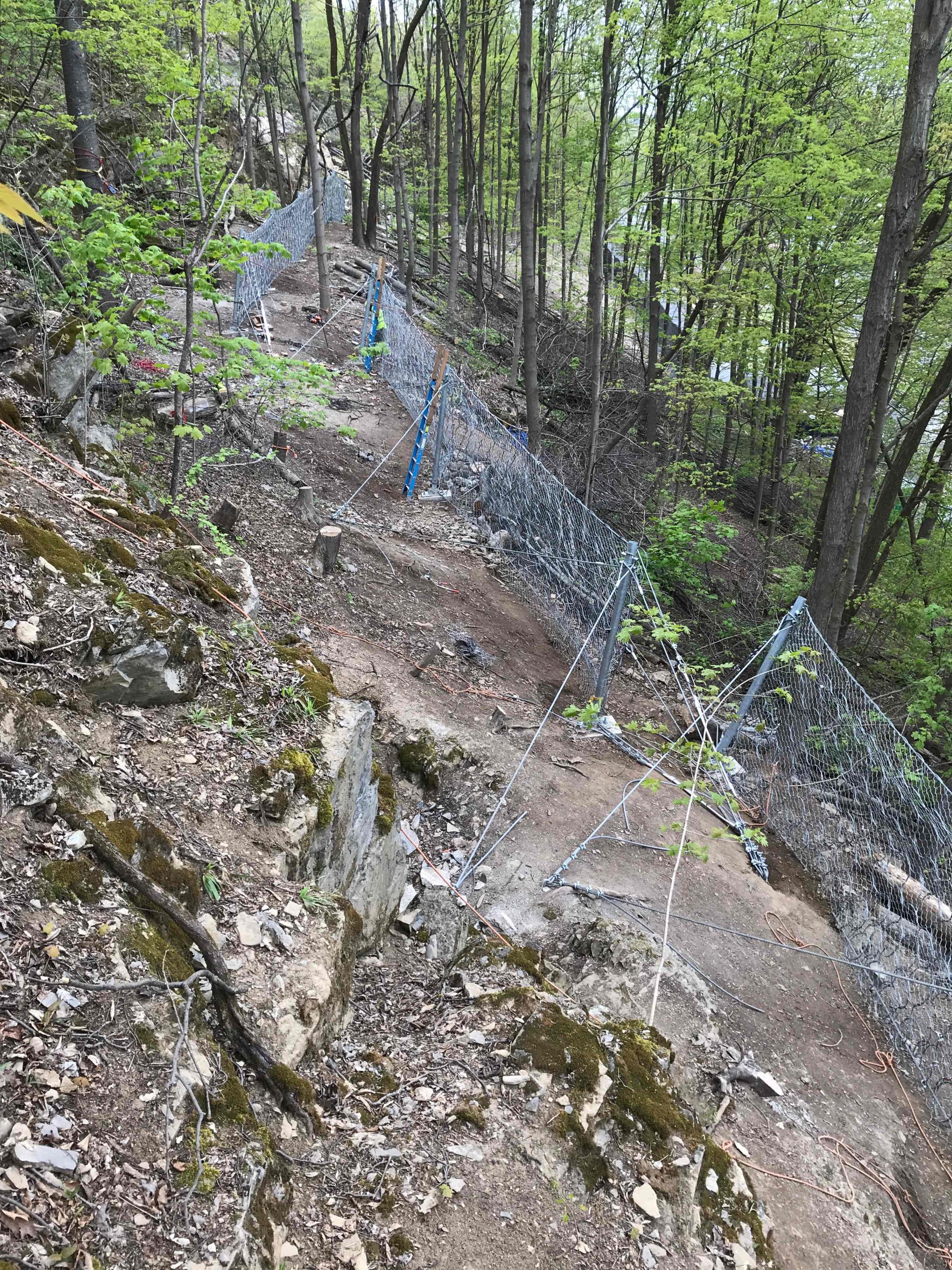
Mississippi's MDOT corridors require mesh systems engineered for the specific rock mass conditions at each site. Access Limited installs standard rockfall mesh for general face coverage, pinned mesh bolted directly to the rock surface for fractured zones, and wire mesh configured for the block sizes present. Draped mesh manages tall and overhanging faces by controlling the fall path from crest to toe without requiring full-face attachment.
For the highest-energy zones along US-61 along the Mississippi River loess bluffs, I-55 through the loess hills, Natchez Trace Parkway, and US-82 across the Black Prairie, cable net mesh and anchored mesh provide the structural capacity that standard mesh cannot match. Rockfall netting addresses lower-energy areas where lighter-weight containment is appropriate.
Flexible rockfall barriers intercept falling rock mid-trajectory — rated from 100 kJ for moderate rockfall zones to over 5,000 kJ for Mississippi's most severe corridors. Catch fences provide cost-effective containment at ditch lines. Rock bolting and rock anchors stabilize fractured zones by reinforcing the discontinuities that define potential failure blocks. Attenuation systems reduce energy through staged curtains on long slopes where single barriers cannot absorb the full impact.
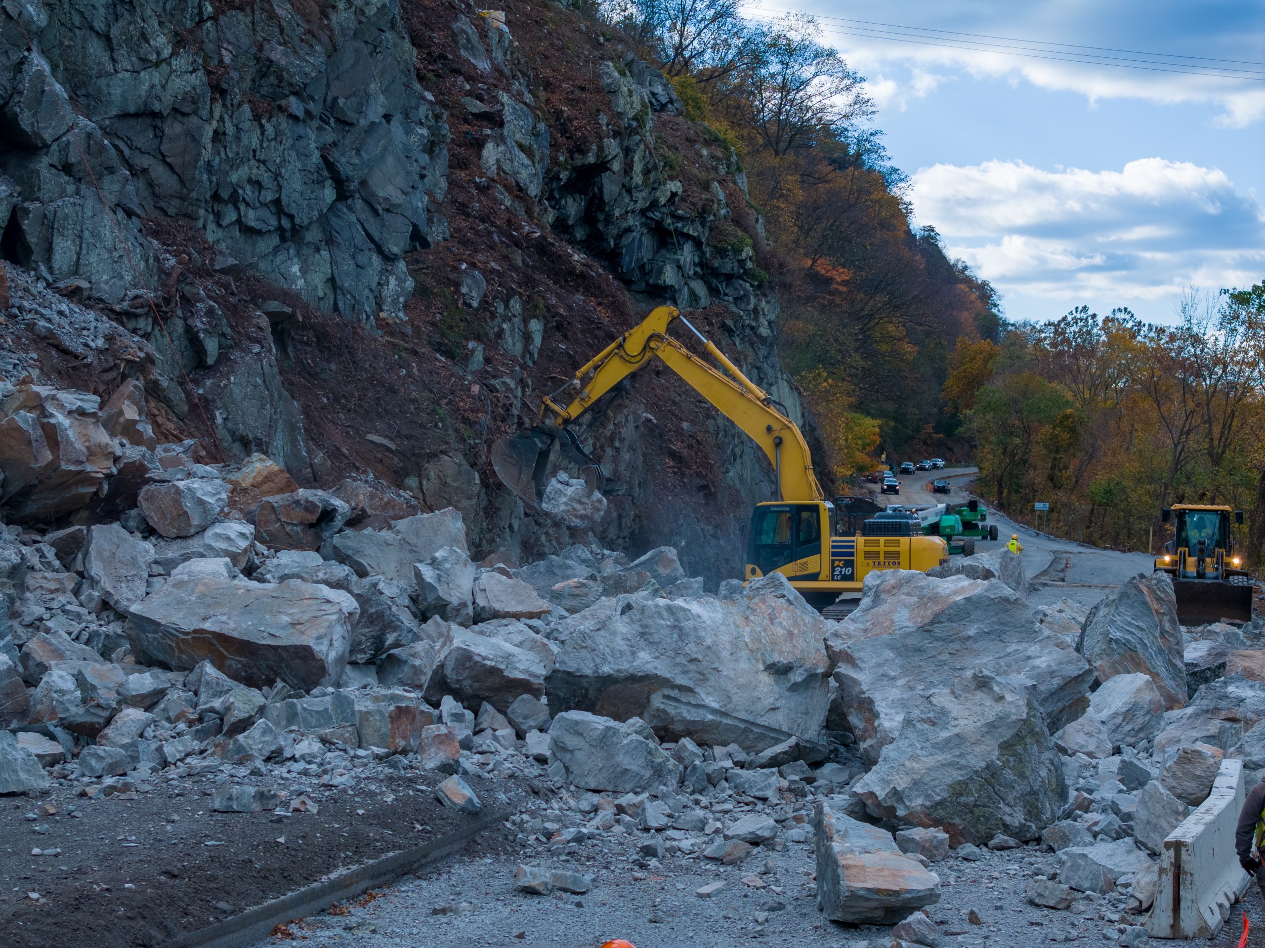
Access Limited's scaling services in Mississippi include mechanical scaling with Spider Excavators, manual scaling by rope-access certified crews, remote scaling for hazardous faces, controlled blasting for large unstable masses, and boulder breaking for oversized detached blocks.
Every system Access Limited installs in Mississippi is engineered for the conditions at the specific site. View all geohazard mitigation services available in Mississippi.
See why MDOT, NPS (Natchez Trace), Army Corps of Engineers, levee districts, and pipeline operators trust Access Limited for rockfall mitigation in Mississippi and across the nation.
Whether you need rockfall containment, emergency scaling, or a comprehensive slope assessment — Access Limited is Mississippi's rockfall mitigation specialist.