UAS-Based Geohazard Assessments

Enhancing Safety and Accuracy

What is a UAS-based geohazard assessment?

A UAS-based geohazard assessment refers to the use of Unmanned Aerial Systems (UAS), commonly known as drones, to collect data and assess potential geological hazards. This assessment involves utilizing UAS equipment to capture photographs, create 3D models, and collect lidar data in areas that are difficult to access or heavily vegetated. By using UAS technology, geotechnical engineers and construction professionals are able to obtain accurate and high-quality measurements, which are essential for analyzing the causes of slope failures and designing effective mitigation solutions. Additionally, the data collected from UAS platforms can be utilized for tasks such as creating landslide inventories, monitoring changes in slope conditions, and modeling geohazard susceptibility. This information can then be used in risk assessment and asset management programs, enabling data-driven decision-making and promoting safer and more efficient construction practices.

CONTACT US

How are UAS-based geohazard assessments conducted?

UAS-based geohazard assessments are conducted using specialized UAS equipment and techniques. Here is an overview of the process:

Step 1

Data Collection

UAS equipment, such as drones, is used to collect aerial photographs and lidar data in heavily vegetated areas. These data sources are essential for creating accurate 3D models of the slope and surrounding terrain.

Step 2

Structure-from-Motion (SfM) Point Cloud Models

The collected photographs are processed using Structure-from-Motion (SfM) techniques to generate detailed point cloud models. These models provide a high level of accuracy and help in identifying potential geohazards.

Step 3

Geohazard Investigation

The point cloud models are analyzed by geotechnical engineers to identify slope failures, landslide inventories, and changes in slope conditions. This investigation helps in understanding the root causes of geohazards and designing effective mitigation solutions.

Step 4

Risk Assessment and Asset Management

The data collected from UAS platforms is used as a key input in risk assessment and asset management programs. This data-driven approach helps in making informed decisions and prioritizing expenses for geohazard mitigation.

What types of geohazards can be identified using UAS-based assessments?

UAS-based assessments can identify various types of geohazards. Here are some examples:

UAS data collection and analysis can help identify areas of slope instability, such as landslides, rockfalls, and soil erosion. This information is crucial for understanding the potential risks and designing appropriate mitigation measures.

UAS platforms can be used to create detailed inventories of landslides in a given area. This information is valuable for assessing the extent and frequency of landslides, as well as identifying areas prone to future slope failures.

By comparing UAS data collected at different time intervals, geotechnical engineers can detect changes in slope conditions. This includes identifying new cracks, movement of soil or rocks, or changes in vegetation cover. Timely detection of such changes can help prevent potential geohazards.

UAS data can be used to model the susceptibility of an area to various geohazards. By analyzing factors such as slope gradient, soil type, and vegetation cover, engineers can assess the likelihood of different types of geohazards occurring in a specific location.

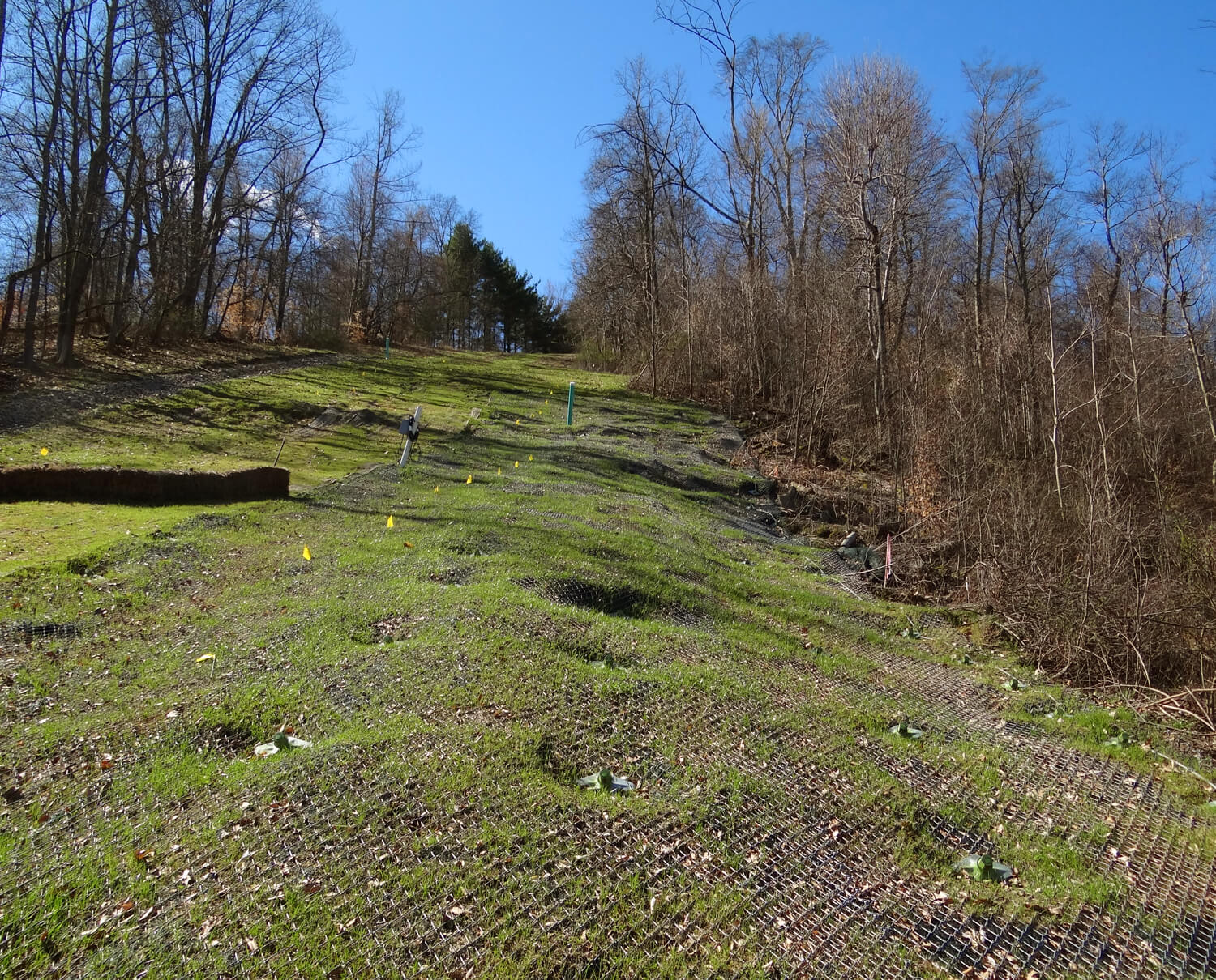
UAS Equipment for Data Collection

UAS equipment, such as drones, is used for data collection in geohazard assessments. These devices offer several advantages:

  • Aerial Photography: Drones capture high-resolution aerial photographs, providing detailed visual information of the slope and surrounding areas. This data is crucial for identifying potential geohazards and assessing their severity.
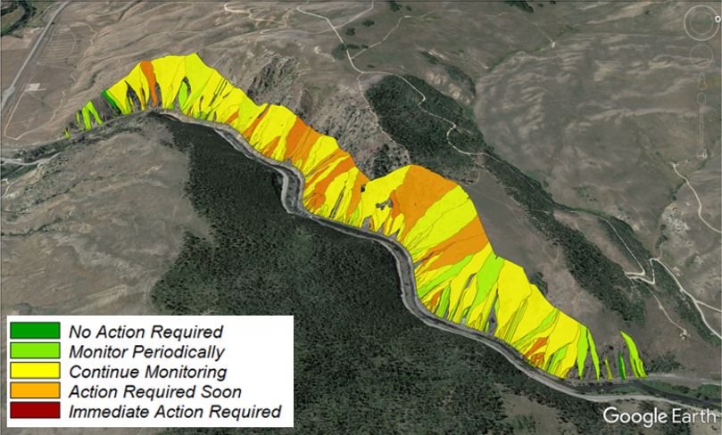
  • Lidar Data Collection: In heavily vegetated areas, UAS platforms can collect lidar data, which uses laser technology to measure the distance between the drone and the ground. This data helps in creating accurate 3D models of the terrain, even in challenging environments.

CONTACT US

Get in Touch

Contact Us Today

Benefits of UAS for Geohazard Investigation and Mitigation Projects

Utilizing UAS technology in geohazard investigation and mitigation projects offers several benefits:

  • Safer Data Collection: UAS equipment allows access to difficult-to-reach places, reducing the need for personnel to physically access hazardous areas. This enhances safety during data collection and minimizes potential risks.
  • Faster Turnaround: UAS-based data collection streamlines the design process by providing accurate and up-to-date information from the right places. This speeds up the assessment and mitigation planning stages, leading to faster project turnaround times.
  • Best-Value Designs: UAS data collection minimizes unknowns and provides detailed measurements, enabling engineers to optimize designs and mitigate geohazards effectively. This results in best-value solutions that address the root causes of geohazards.
  • Better Communication: UAS-based assessments generate rich visuals, including aerial photographs and 3D models, that can be easily understood by stakeholders. This improves communication and facilitates collaboration among project teams, leading to better decision-making.
  • Prioritize Expenses: UAS data collection provides comprehensive, wide-area data that helps in managing assets and prioritizing expenses. By understanding the extent and severity of geohazards, resources can be allocated efficiently for mitigation efforts.
GET IN TOUCH

Take Advantage of UAS-Based Geohazard Assessments Today

Discover the benefits of UAS-based geohazard assessments for your projects. Contact us now to leverage the power of UAS equipment, UAV capabilities, and data-driven decision-making. Enhance safety, accuracy, and efficiency in your geotechnical engineering and construction endeavors. Let us help you mitigate geohazards and optimize designs with our expertise and attention to detail. Reach out to us today for a consultation.

805.727.4310

    How Can We Help?

    • Personal Info

    • Contact Info

    • Project Info


    How Can We Help?

    • Personal Info

    • Contact Info

    • Project Info


    How Can We Help?

    • Personal Info

    • Contact Info

    • Project Info