Maine's rocky coastline faces persistent erosion from Atlantic storms and rising sea levels along US-1 Downeast, a slower but steady {EROSION_LINK} risk that outranks the state's more limited rockfall and slope concerns.


Maine's rocky coastline faces erosion from Atlantic storms and rising sea levels, a slower but persistent process along US-1 Downeast and the state's extensive shoreline communities. Inland, granite bedrock and the state's rocky terrain produce occasional retaining wall challenges where highway cuts meet fractured rock, while the Presumpscot Formation, a sensitive marine clay left behind by the postglacial sea, adds a distinct slope stability risk in Maine's coastal lowlands.
This is a familiar Seepage and Internal Erosion Problems pattern for MaineDOT, repeated at sites across the state.
Maine faces risk across erosion control, retaining systems, slope instability. GSI's response to each is ranked by actual fit to the state's conditions.
Driven by Atlantic storm and sea level rise coastal erosion, this shows up across Maine. GSI's response is coastal and bluff stabilization.
Maine sees this where granite bedrock highway cuts. GSI resolves it with tiebacks.
Maine infrastructure owners see this from sensitive Presumpscot Formation marine clay, resolved by GSI using soil nailing.
Maine's rocky coastline faces persistent erosion from Atlantic storms and rising sea levels along US-1 Downeast, a slower but steady {EROSION_LINK} risk that outranks the state's more limited rockfall and slope concerns.
Maine's granite bedrock and rocky terrain occasionally require {RETAINING_LINK} solutions where highway cuts meet fractured rock, a more localized concern than the state's coastal erosion.
The Presumpscot Formation is a sensitive marine clay left behind by the postglacial sea that once covered Maine's coastal lowlands, producing {SLOPE_LINK} risk through sudden, retrogressive failures distinct from gradual soil creep.
Yes, GSI maintains {FLOOD_LINK} for Maine's coastal and inland flooding events.
I-95 and US-1 Downeast both run along or near Maine's eroding coastline, while inland corridors cross granite terrain and Presumpscot clay lowlands.
GSI's {DESIGNBUILD_LINK} model addresses Maine's granite bedrock, coastal erosion, and Presumpscot clay as three distinct engineering considerations rather than a single statewide approach.
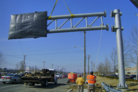
Corridors prone to washouts and scour often need updated warning signage alongside the structural repair. RoadGuard installs highway signage and sign structures built to the same standards as the roadway itself.
From erosion control to slope instability, GSI's engineers are ready to assess your Maine site.