North Carolina's Outer Banks—one of the most dynamic barrier island systems in the world—faces chronic erosion from hurricane storm surge, Nor'easter wave energy, and rising sea levels. Cape Hatteras, Brunswick County's south-facing beaches, and New Hanover County's shoreline require engineered protection that accounts for rapid sediment transport, inlet migration, and the extreme storm loading that defines the Carolina coast. GeoStabilization International designs revetment systems and soil bioengineering solutions calibrated to North Carolina's unique coastal dynamics.
Our engineers integrate wave energy modeling, sediment transport analysis, and storm surge projections to design protection that performs under the hurricane conditions the Carolina coast routinely experiences.
North Carolina's Outer Banks barrier island system—one of the most dynamic coastal environments in the world—faces erosion from hurricane storm surge, Nor'easter wave energy, tidal inlet migration, and accelerating sea level rise. Cape Hatteras National Seashore experiences overwash events that breach Highway 12—the only road serving Outer Banks communities. Brunswick County's south-facing beaches and New Hanover County's shoreline face chronic retreat that threatens coastal infrastructure, highway access, and utility corridors.
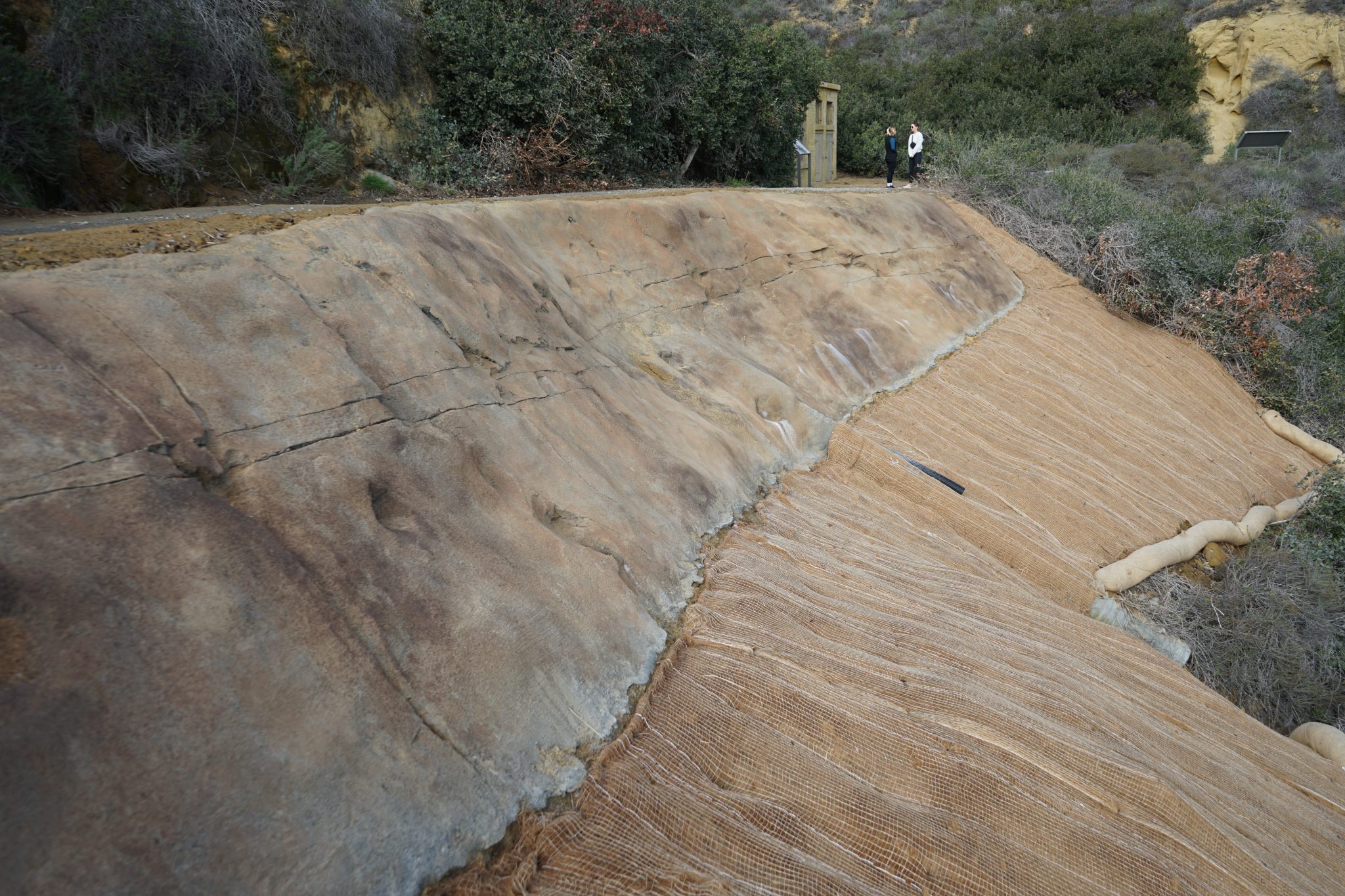
GeoStabilization International designs coastal protection systems calibrated for hurricane-force conditions—not fair-weather assumptions. Revetment systems use wave energy dissipation principles validated through performance during Category 3+ storm events. Soil bioengineering integrates living root systems with structural reinforcement for long-term resilience that strengthens over time as vegetation matures. Each solution is designed using FEMA storm surge modeling, USACE wave height projections, and site-specific sediment transport analysis.
Highway 12's vulnerability to overwash and inlet formation demands coastal engineering that accounts for barrier island dynamics—not static shoreline assumptions. GeoStabilization International's engineers design protection that functions within the Outer Banks' dynamic sediment system, maintaining highway access while allowing natural coastal processes to continue where possible. This integrated approach satisfies both NCDOT infrastructure needs and National Park Service environmental requirements.

North Carolina's coastline will face another Category 3+ hurricane. GeoStabilization International designs coastal protection systems that perform under hurricane-force conditions—not fair-weather assumptions that fail when tested by real storms. Our revetment specifications, wave energy calculations, and material selections are validated through performance data from actual hurricane events along the southeastern coast. When the next storm hits, your protection is already engineered for the forces it will face.
Shoreline stakeholders from the Outer Banks to the Carolina coast describe their experience with GeoStabilization International's coastal solutions.
Outer Banks to Brunswick County—GeoStabilization International delivers hurricane-rated coastal protection that performs when it matters most. Talk to a coastal engineer today.