
When a river carves away at a roadway embankment, the consequences can be swift and severe. Along Route 619 in Isle of Wight County, Virginia, the Blackwater River had been steadily scouring the embankment supporting the roadway — threatening the long-term viability of a road critical to the surrounding community.
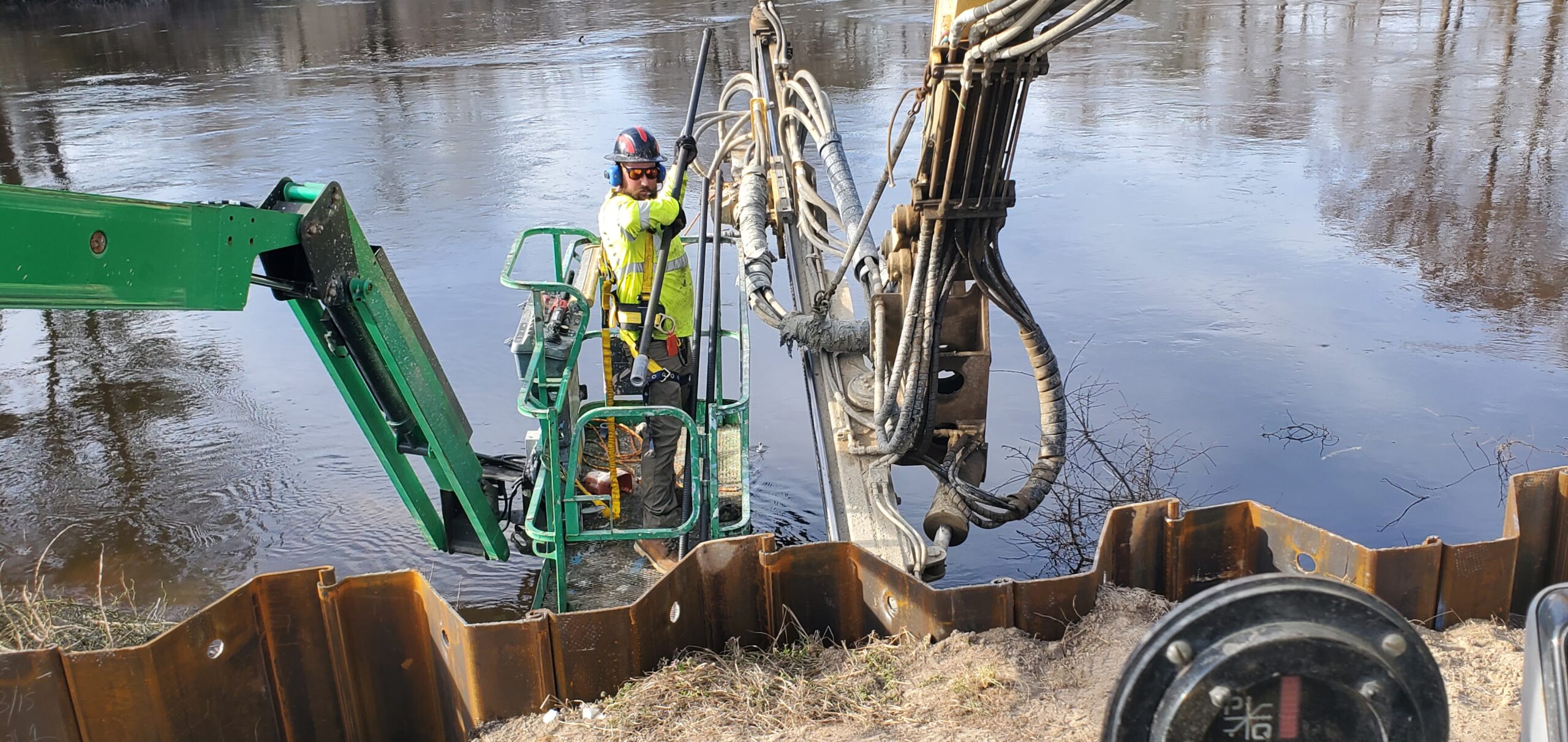
GSI engineers first evaluated the site conditions in February 2023 and confirmed that river scour had progressively undermined the embankment along three separate sections of Route 619 measuring 186 feet, 66 feet, and 36 feet in length. The road itself was narrow — just 16 feet wide at Site 1 and approximately 20 feet at Sites 2 and 3 — leaving little working room for conventional repair methods. Proximity to the Blackwater River required solutions that could be installed in tight, wet conditions while protecting the roadway from further hydraulic attack.
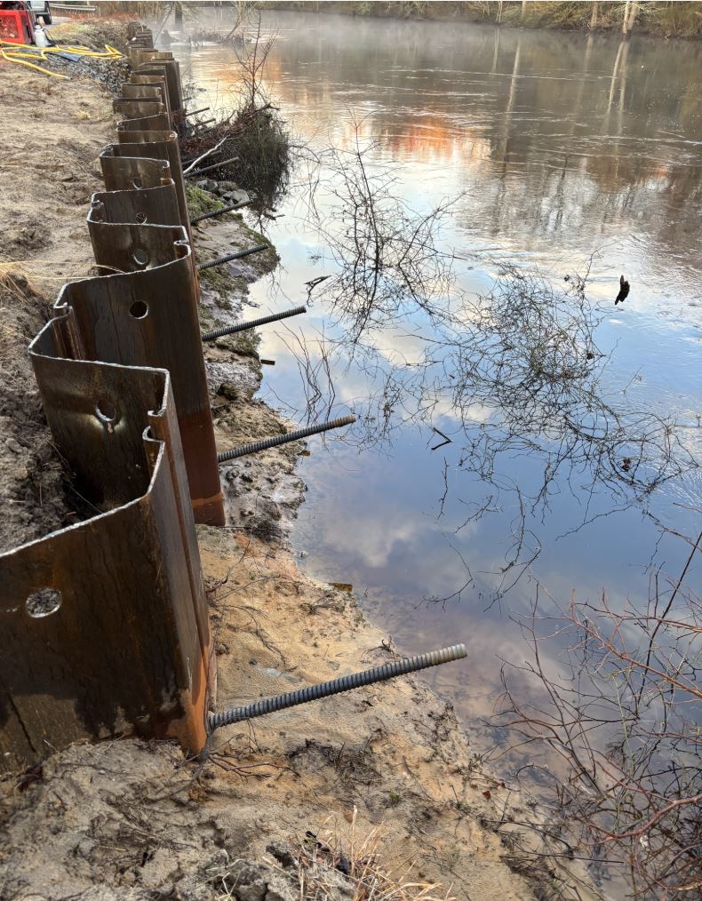
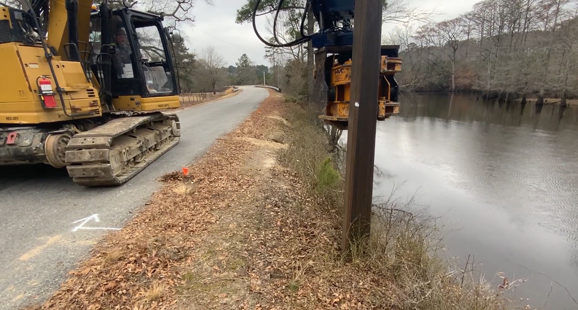
GeoStabilization developed a solution that combined multiple stabilization techniques to address both immediate instability and long-term scour protection. Crews drove sheet piles up to 15 feet long along each site, positioned 1 foot behind existing guardrail posts to maximize coverage without roadway closure. Two rows of soil nails up to 20 feet long were then installed to tie the sheet piles back into stable embankment material. With the structural elements in place, flowable fill was placed between the roadway and the sheet piles to encapsulate the soil nails and protect them from corrosion. The remaining void was finished with crusher-run shoulder gravel, restoring the roadway shoulder profile and providing a durable working surface.
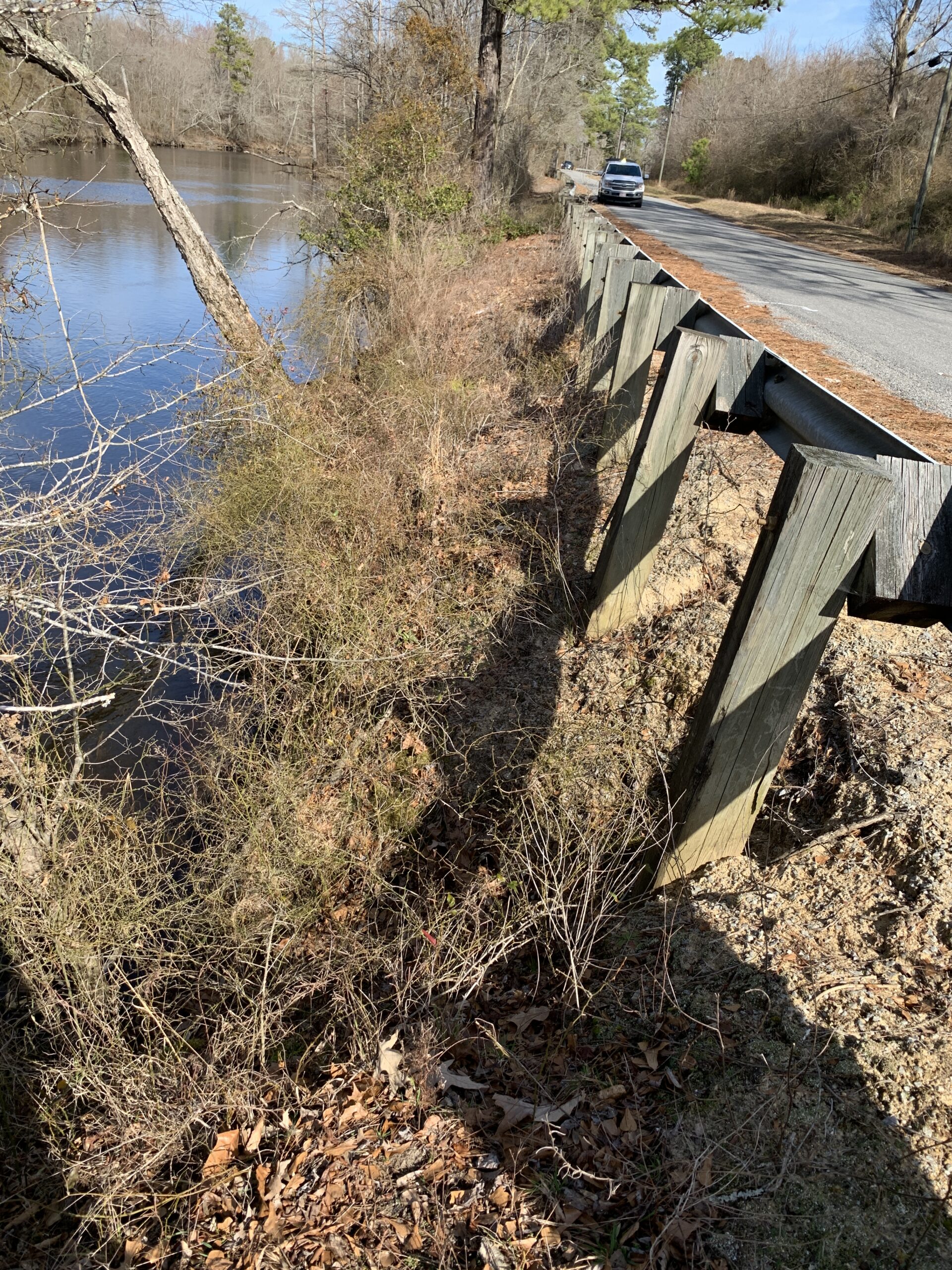
The completed project stabilized all three failure sections along Route 619 and restored the embankment's resistance to future scour events. By integrating sheet piling, soil nails, and corrosion protection into a single efficient construction sequence, GeoStabilization protected a vital rural corridor and delivered long-term resilience for VDOT's Hampton Roads District.